“To walk in nature is to witness a thousand miracles.”
–Mary Davis
Last year started off with a bang! I had signed up to do couple of half marathons in Spring and was happy with the way the training was progressing. But by March, the pandemic hit and the in-person races started getting canceled one after the other. With many organizations swiftly switching to virtual races, I also started signing up to participate with my friends in quite a few virtual biking and running challenges ranging from 5Ks to 10Ks to Half Marathons supporting different charities like St Jude’s and Vibha.
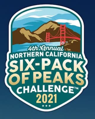
Feeling accomplished by the end of the year but sadly with no signs of Covid infections coming down, I started looking into something different to keep myself active this year and that’s when I came across the Six-pack of Peaks challenge. It is a regional event where participants are challenged to summit six different peaks in the area where they live, anytime during the whole year. That sounded like an interesting challenge to take on with a lot of flexibility to explore new trails at the same time getting to spend quality time with my loved ones as well.
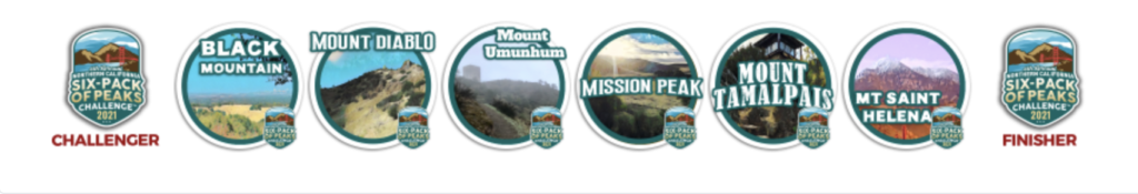
The following are the six peaks in Northern California:
Black Mountain
Mount Diablo
Mount Umunhum
Mission Peak
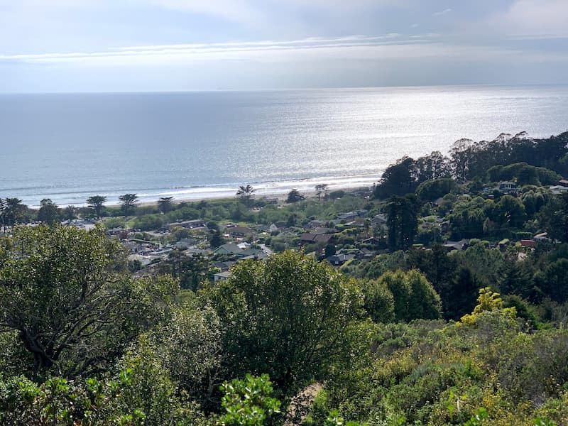
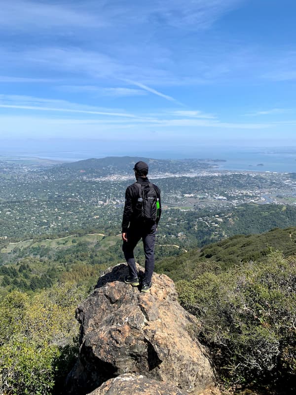
Mount Tamalpais
Mount Saint Helena
Black Mountain
Trail: Black Mountain via PG&E in Rancho San Antonio Open Space Preserve
Total distance: 11.2 miles out and back
Average time to hike: 5 hours
Elevation: 3146 feet
Difficulty: Hard
Parking: Rancho San Antonio parking lots. Trailhead is near Equestrian lot. Gets very busy on weekends.
Sometimes things work unexpectedly and I like such little surprises. In mid January, we all planned on a group hike to the PG&E trail, an eight mile loop from the equestrian parking lot of Rancho San Antonio Open Space Preserve. But by the time we reached mid point on the trail from where it forks to Black Mountain trail, someone asked if we should just make use of the good weather and try to summit it. This is one of my favorite trails and even though I had hiked this quite a few times prior, having just signed up for the challenge, I was all for it and indeed it felt good doing the hike again as part of it.

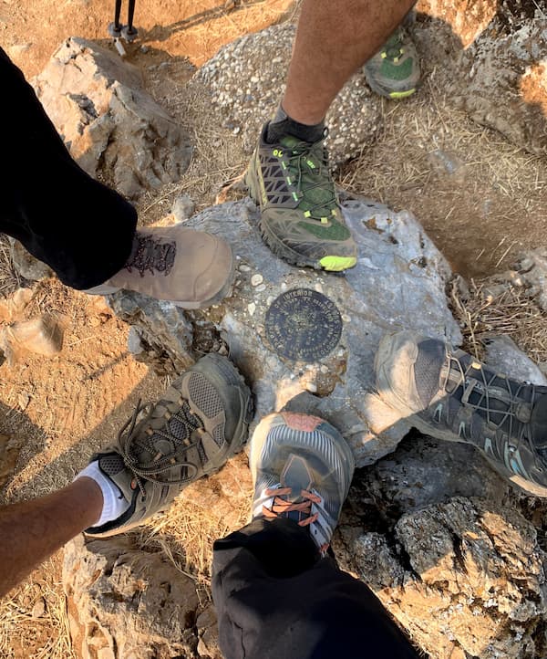
We made the ascend at the same time taking in the beautiful views of the valley beneath us with clear views of NASA, the bridges, and many familiar landmarks of the area. In no time we were at the summit all the while chatting away. We were so thrilled to see the communication towers on the top coming into clear view that seemed so far away when we started the hike three hours earlier. There are many interconnected trails in Rancho San Antonio that leads to the summit and based on your ability level, you can choose one that works for you.
Mount Diablo
Trail: Mt Diablo via Mitchell Canyon Loop
Total distance: 13.0 mile loop
Average time to hike: 5 to 7 hours
Elevation: 3822 feet
Difficulty: Strenuous
Parking: Mitchell Canyon visitor center (take exact change for parking to deposit in an envelope). Go early to find easy parking.
Located in Mt Diablo State Park, one of the tallest peaks in Bay Area and rightfully added as part of this challenge is something many new hikers has it as their bucket list item. We did this hike in Feb when the weather was really pleasant with mild drizzles on and off when we were on the trail. It is quite popular in Spring and Fall and not so much during the dry summer season. Mt Diablo is the recommended one in Bay Area to train for epic hikes like Half Dome and Mt Whitney.

This hike could be done clockwise or counter clockwise. My favorite part of the trail is the more challenging ridge side with vastly spread out views of the valley down below where you will cross couple of peaks along the way, Twin Peaks and Eagle Peak. It’s good to carry at least 3L of water and a good navigation system to make sure you are on track as there are many forks on this side of the trail. Also hiking poles would definitely help, especially during dry season as the terrain on the ridge side is quite rocky and helps with the support. On the more gentler fire lane side of the loop, which passes through the Juniper campground, a mile away from the summit while going down, there are nice picnic areas with restrooms and fountains to refill water. The summit is reachable by vehicles also which makes it more crowded than the trails. From the summit we get such expansive views of the entire area that on a clear day, some 30+ out of the 58 counties in California can be seen from the top. Out of the six peaks, this would be the most strenuous one based on both the distance and elevation combined.
Mount Umunhum
Trail: Mt Umunhum summit in Sierra Azul Open Space Preserve
Total distance: 7.7 mile out and back
Average time to hike: 3 hours
Elevation gain: 1187 feet
Difficulty: Moderate
Parking: Bald Mountain parking or at the summit
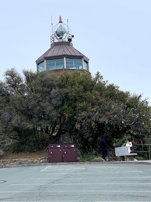
Mt Umunhum is situated in the Sierra Azul Open Space Preserve in Santa Cruz mountains. At 3486 feet it is one of the highest peaks with its radar tower visible from mostly anywhere in Silicon Valley. The summit could be reached by hiking varying distances from lower elevations each one more challenging than the other. The one above from Bald Mountain is the shortest at 7.7 miles to the summit and back. When we reached the small Bald Mountain parking lot, it was already filled up and so we went and parked at the summit and did the trail in reverse direction.


Before we started the hike, took the steps to get an up close view of the “Cube” or “The Box” which towers over the valley. This place brims with history on how native Indians called it home for many years before it became the “Silicon Valley”. The trail is mostly shaded with lots of California Bay and Madrone trees and the hike itself is pretty moderate. The drive up to the summit was quite windy though and we had to drive carefully as the narrow road was shared by a lot of mountain bikers. This easily qualifies as a nice weekend hike if you don’t mind driving up the windy road.
Mission Peak
Trail:
Mission Peak loop from Stanford Staging area (5.8 miles, 2135 feet elevation gain)
Mission Peak loop from Ohlone College  (7.3 miles, 2145 feet elevation gain)
Average time to hike: 3.5 hours
Difficulty: Hard
Parking: Stanford Ave lot or Ohlone College parking garage
The most popular one in this list for sure! Every now and then I get invited by friends to join them on this hike and I enjoy it every single time with Spring being my favorite season where the meadows with cows grazing looks like European country side. Weekend mornings are usually pretty crowded and parking may be an issue.


The hike up from Ohlone college is little more gentler compared to the one from Stanford Staging area. There are many trails to the summit but the above mentioned ones are the most popular. It is a constant uphill climb with the last stretch more steeper on a rocky terrain which some may find challenging. Distance wise it is an ideal one to get it done on a weekend morning before getting on with the day. The Mission Peak is famously known for its full moon hikes also. If you want to try it out, checkout my blog on Full Moon Hike to the Mission Peak.
Mount Tamalpais
Trail: Stinson Beach to Mt Tamalpais (DipSea Trail -> Steep Ravine Trail -> Pantoll Ranger Station -> Summit via West Point Inn -> Pantoll Ranger Station -> Matt Davis Trail -> DipSea Trail)
Total distance: 17 mile out and back
Average time to hike: 6 to 8 hours
Elevation gain: 3717 feet
Difficulty: Hard
Parking: Stinson beach or roadside parking near the trailhead
Considered as one of the most beautiful hikes with sweeping views of the San Francisco Bay on the way to its peak, Mt Tam as it is more commonly called is almost as popular as the Muir Woods nearby and in every hiker’s list. On most days, Karl the fog is a constant companion on this hike bringing out the misty atmosphere. There are so many trails there where you can hike everyday for a month without having to repeat the same trail more than once! We chose to do the DipSea trail from Stinson Beach to the summit via forested Steep Ravine Trail with streams and waterfalls. On the way back we took Matt Davis Trail back to DipSea trailhead along the rim filled with stretched out views of the Pacific ocean shimmering in sunlight and wildflowers in full bloom. It took about 8 hours including all the breaks and the time I spent on taking pictures.

We encountered an unexpected situation where we almost ran out of gas as we neared Stinson beach and were taken aback when we heard there are no gas stations in Stinson Beach. Thankfully the friendly firefighters at the local fire station helped us by filling it up enough for us to get back to Mill Valley. So something to keep in mind if you plan to start the hike at Stinson beach!
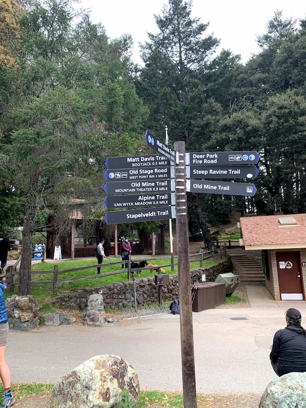
The Pantoll Ranger Station mid-way is a good place to take a lunch or snack break and it has restrooms. We were hoping the West Point Inn on the way to the summit would be open to have pancake breakfast but was disappointed to find it closed. After a wonderful hike which I would call as a moderate one, icy cold waters in Stinson Beach provided the extra comfort where we got to soak our tired feet to naturally get rid of inflammation. We ended the day with the promise to go back soon to try yet another trail the next time!
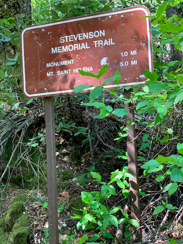
Mount Saint Helena
Trail: Mt Saint Helena Trail in Napa Valley / Robert Louis Stevenson State Park
Total distance: 9.3 mile out and back
Average time to hike: 4 hours
Elevation gain: 2009 feet
Difficulty: Moderately Hard
Parking: Stevenson Memorial Trailhead
This is the farthest one from where we live, but the drive was pleasant on a Saturday morning through the Golden Gate Bridge and some coastal towns like Sausalito before going up the mountains in the wine country near Calistoga. We reached there close to 11:00am and the small parking lot was full but we managed to find roadside parking. There are no restrooms or even a port-a-potty at the trailhead or on the trail. So if you are going there, it may be good to plan on doing a restroom stop before reaching the trailhead.
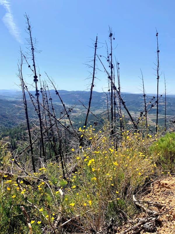
The hike started out at an elevation of 2000 ft on a beautiful stretch of switchbacks that is thickly wooded and it wasn’t crowded at all. Along the way, we saw the Robert Louis Stevenson monument. In about a mile, we reached the fire lane and were soon out in the sun. From here on it was a gradual climb for the next four miles all the way up to the summit. The views of the Napa valley and beyond down below were wonderful at the same time it was sad to see the remnants of the recent Napa wildfires where we actually got to see how so much of vegetation got wiped out. The trail also had a perfect spot for rock climbers and we saw a few practicing their climbs. Even though it was fully exposed with so little shade all along, due to the elevation we got to enjoy the mild breeze throughout. In little more than two hours we reached the summit where we relaxed for sometime and had our packed lunch before we started our climb down. Even though this is the highest of the six peaks in elevation, it would still be a moderate one because we gain only about 2200 ft in elevation.
Conclusion
What I really liked about this challenge is that it was quite encouraging to see others doing it with you virtually at the same time raise money for a good cause and motivate each other by sharing the experiences in online forums. All hikes being local and spread out across bay area, this challenge enabled me to to go on a day hike and explore nearby areas at the same time it was fun doing it with friends and family. Good to try out this challenge if you can.
Check out my other blogs at Trails and Summits. Happy Hiking!!